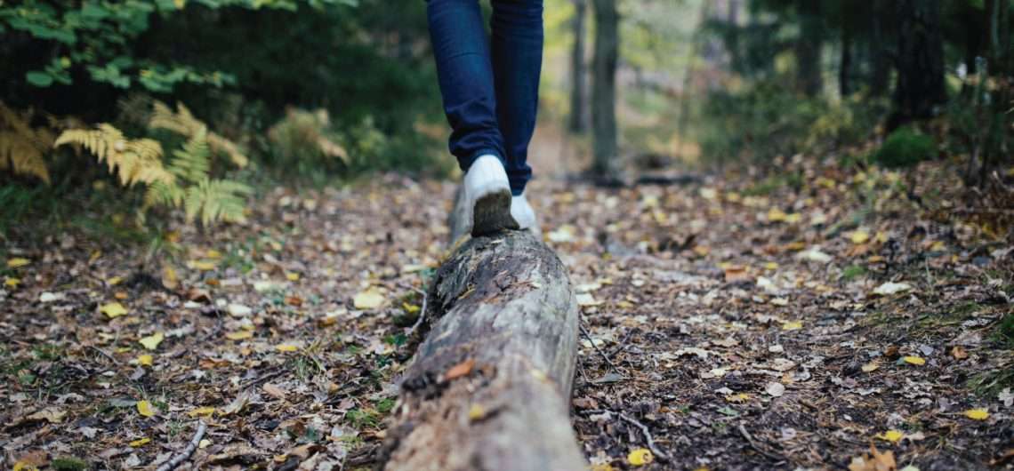
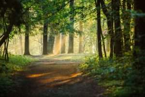
Hiking in Latvia and discover the most spectacular routes. You can walk the shoreline, you can wander through river valleys and forests, you can just watch the landscape. Here is some hiking routs in Latvia.
——————SIGULDA—————–
Three Castle Route (6 km /4h)
Location – Sigulda, train station
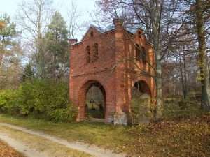
Route: Sigulda train station – Pils Street – Key Square – Sigulda Medieval castle and New castle – Sigulda Lutheran Church – Walking Stick Park – cable car – Krimulda manor and Krimulda Medieval castle ruins – Serpentine road – Gūtmans’ Cave – Turaida Museum Reserve. Return by bus No. 12.
Sigulda in tales and legends: large route (13 km /4,5 h)
Location – Sigulda, train station
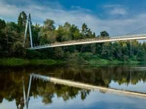
Route: Sigulda train station – Pils Street – monument to Kr. Barons – Sigulda Medieval castle and New castle – Sigulda Lutheran Church – Walking Stick Park – chair lift – pathway along the Gauja River – pedestrians bridge across Gauja River – Krimulda manor and Krimulda Medieval castle ruins – Serpentine road – Gauja bridge – stairs up to the town – Festivity Square – Sigulda train station
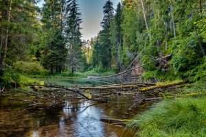
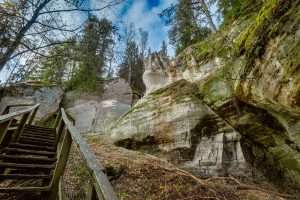
Gauja valley picturesque nature (6 km /3 h)
Location – Sigulda, train station
Route: Sigulda train station – Walking Stick park – stairs down to Gauja bridge – pathway along the Gauja River right bank to Līgatne side – Olu hill – rest area Vējupīte – Ravens ravine and cave – Painter’s Hill – Sigulda train station
——————CĒSIS——————
Cīrulīši Nature Trails (4,6 km /3 h)
Route map HERE
 The Cīrulīši Nature Trails will introduce you to the evolution of the beautiful Gauja River valley from Ice age to nowadays! The Cīrulīši nature trails at Cēsis reveal the history of the Gauja River and its surrounding nature. The area has two comfortable, easy accessible routes – 2,7 km and 4,6 km long. During the walk, fascinating natural objects can be seen: the impressive Cīrulīšu cliffs also called Spoguļu (Mirror) Cliffs beautifully reflect in the water of the oxbow lake. Dzidravots (Clear spring) is place where to quench your thirst after a walk. Legend of Līgavas (Bride) cave legend will again verify the power of love, but Cīrulīšu cave is also called the abyss.
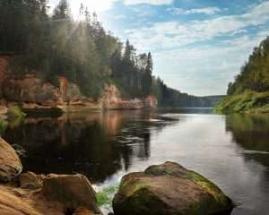
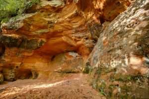
River Amata. Rocks and Cliffs (21 km /10h)
Route map HERE
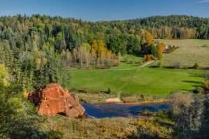 For travellers not afraid of large and frequent terrain differences, and also for those wishing to see and enjoy the beautiful banks of primeval valley of the River Amata while heading along remote forest paths. The path leading along the right bank travels through the upper and lower part of the valley, and therefore at some places difference of more than 40 m in height is experienced. This is sort of a geo-tourism route with an insight of dolomite and sandstone outcrops from the Devonian Period which are found in the primeval valley of the River Amata shaped by the glacier. Route: Amatciems – Melturi – Kārļamuiža – Kārļi – Zvārte Rock – Veclauču Bridge.
Cēsis –Ērgļu Cliffs– Jāņmuiža (14 km /6h)
Route map HERE
Suitable for travellers interested not only in the towns, but also in magnificent landscapes and one of the most monolith sandstone cliff walls in the Baltics — the Ērģeļu Cliffs. Destinations are easily linked with public transportation. Route: Cēsis Railway Station – Raunas iela – Lenču iela – Pieškalni – Ērģeļu Cliffs – Rāmnieki – Jāņmuiža
One Day Around Cēsis (21km / 10h)
Route map HERE
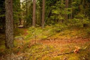
 Suitable for very active hikers interested in nature and physical activities. The route introduces with excellent views of the primeval valley of the River Gauja, the history of the valley since the end of the Ice Age, and the values of boreal forests. The route runs through Gauja National Park.
Route: “Ozolkalns” – Cīrulīši Nature Trails – Mūrlejas iela – Gaujas iela – bridge over the River Gauja – Kvēpenes iela – Lake Raiskums – along the banks of the River Sveķupīte – along the banks of the River Lenčupe – Pārgaujas iela (Sarkanās Cliffs) – bridge over the River Gauja – Gaujas iela – Alkšņu iela – Kovārņu iela – “Cīrulīši” – “Ozolkalns”. Distance: ~ 24 km. You can take the shorter circle till the bridge over the River Gauja ~8 km.
————VALMERA————–
The Ancient Knight path (46km / 2 days)
Route map HERE:
Amazingly picturesque circular route from Valmiera to Sietiņiezis passing through Vaidava and Kocēni is suitable for pedestrians and cyclists. In the past, it has been referred to as a part of the Gauja corridor area of the Livonian Order. This route is also known and mentioned in the Livonian Chronicle of Henry as the Ancient Knight path that connected the ancient Hanseatic cities – Wolmar (Valmiera) and Wenden (Cesis).
Around the Burtnieki Lake (70km / 2 days)
This route will lead you through picturesque landscapes and along the way you will see great variety of nature wonders. You will have an opportunity to come across rare and protected species of plants and animals, especially some species of birds. Several parts of the route are the same as already marked regional route No. 17 and local route No. 112
————-Elsewhere in Latvia————-
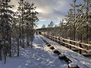
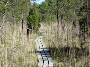
LATVIA / DUNIKA BOG TRAIL (6km)
Location -Rucava district, Dunika parish, LV-3480
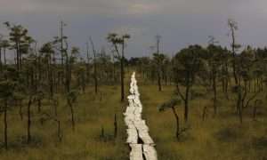
During a walk along the 6 km long Dunika bog footbridge path you can see unbelievably many beautiful and special landscapes with small lakes and clusters of islands. At the end of the trail, you will be able to see Latvia’s only hornbeam pure stand, which is more than one and a half a century old. Dunika Bog Trail is located in the Nature Reserve “Dunika”. The nature reserve with the 7000-year-old Tīrspurvs bog is a peculiar place to visit for everyone.
LATVIA / CENA MOORLAND FOOTPAH (5KM)
Location -Babīte district, Cenas tīrelis, LV-2107
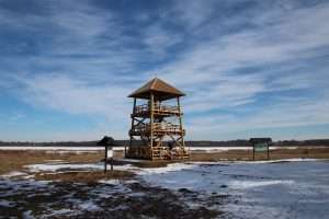
 Cena Moorland is Latvia’s second largest bog, and it is a specially protected nature territory – a nature reserve as well as Natura 2000 territory. Cena Moorland has a 5 km long footpath trail, and in the middle of it, there is a viewing tower that allows to see the moorland from above. Cena Moorland in spring is especially appealing for birdwatchers. 10 of Latvia’s and Europe’s protected bird species as well as several other small birds are there.
LATVIA / THE KANGARU PROCTECTED AREA (2KM)
GPS: 56.919727, 24.729908
The Kangaru protected area is located around the biggest esker ridge in Latvia. The nearby territory hosts a myriad of protected species and biotopes. A wooden plank trail has been made here, to make it possible to visit this territory, without disturbing the local nature. The trail leads to the Kangari lake and is around 2 kilometers long. There are information boards, as well as one of the highest observation towers in Latvia.
LATVIA / POKAINI FOREST (5KM)
Location – Dobele district, Naudīte parish, Pokaiņi, “Senpokaiņi”, LV-3724
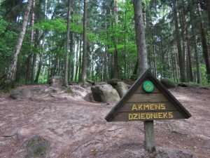
The Pokaini Forest is a picturesque location and an ancient holy site famous for the wondrous legends told about it. Take a walk along the path and find out more about this energetic place. nside the forest, stones form groups, piles, walls and rivers: the Pokaini StoneAgglomerates. These were the main reason why the Pokaini Forest is connected with unusual beliefs and superstitions.
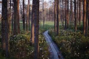
LATVIA /THE WILD NATURE TRAIL BY THE RIVER ROJA (2-15km)
Location – 57°30’23.8″N 22°47’21.4″E
From the spring to fall you can enjoy tours by the river Roja and the nearby forests as on feet, on the bicycles or boats. In the winter – hop on the skies and enjoy the crisp air. There are three spots to relax during the trails. They are equipped with tables and chairs, lavatories, swings, gyms and trash bins. And of course a bonfire place and spots for tents. By the settlement in Zocene and Roja there are boat docks. The nature trail slits up in three circles and they are marked with different colours in the nature. The smallest route is 2km – yellow, the middle route – 7km – blue, and the longest route – 15km – red.
The river Roja is embodied with a pristine forest, where no landscaping of the man has taken place. They are biologically old, rich with plants and trees and animals. It’s a rare thing in even the forest filled Latvia. The banks of the river are inhabited by beavers, otters, does, wild boars, athraxes, mooses, and many different specie birds.
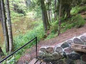
LATVIA /CIECERE NATURE TRAIL (750m)
Location – 56°40’01.9″N 22°29’26.9″E
Nature and walk trail wends its way along the Ciecere River, from Kuldīga Street bridge to children playground. The trail is one of the most progressive nature-study-walk trails designed for people with special needs. The trail is enclosed by railings, no stairs and steep rises/falls. Moreover, this is the only nature trail built in the central part of the District centre and aimed at studying and telling about nature elements in the city environment, for instance, such a common species of plants as a ground-elder.
LATVIA /EZERE NATURE AND HISTORY TRAIL (3KM)
Location – Ezere Parish
 Excellent leisure, beautiful scenery and historical objects can be enjoyed in entertaining, educational adventure along Ezeres nature and history trail. It is possible to view Customs house where the act of surrender was signed by Germans on 8 May 1945. The trail starts from Ezeres manor and is 3 km long.
LATVIA /THE PETEREZERS NATURE TRAIL (3,5KM)
Location – P125 LV-3275, Latvija
This circular trail features a unique landscape of parallel rampart-type sand dunes and grassy swamps among the dunes. This landscape offers evidence of the geological history of the Baltic Sea. There is a high-type swamp (the Pēterzers swamp), along with remnants of an old narrow-gauge railway. Wooden pathways have been installed along the swamp and the surrounding wetlands.
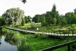
LATVIA /NATURE PARK ENGURE LAKE (3,5KM)
Location – P125 LV-3275, Latvija
 The flood-land meadows, the grassy bogs, and the damp forests of the country park “Lake Engure” can boast with the versatility of the orchid species – in the area of Engure. There are 22 of the 32 orchid species growing in Latvia. At the country park, you can also see lavish presence of the fly orchids – it is a very rare orchid, which can be found only in Kurzeme. In order for the visitors of the country park to have an opportunity to see these rare species of plants, the Orchid Trail has been set up. The total distance of the trail is 3.5 km, it begins near from the Centre of Ornithological Researches at Lake Engure, it winds through the calcareous bogs and the forest in the direction of the bird watching tower, and winds further down – along the meadows of the lake coast, where wild cows and horses have found their dwelling grounds. At the starting point of the trail, there is an information sign, where the orchids found in the area are displayed. The information stand also gives versatile information on other interesting plant species of the country park “Lake Engure”.